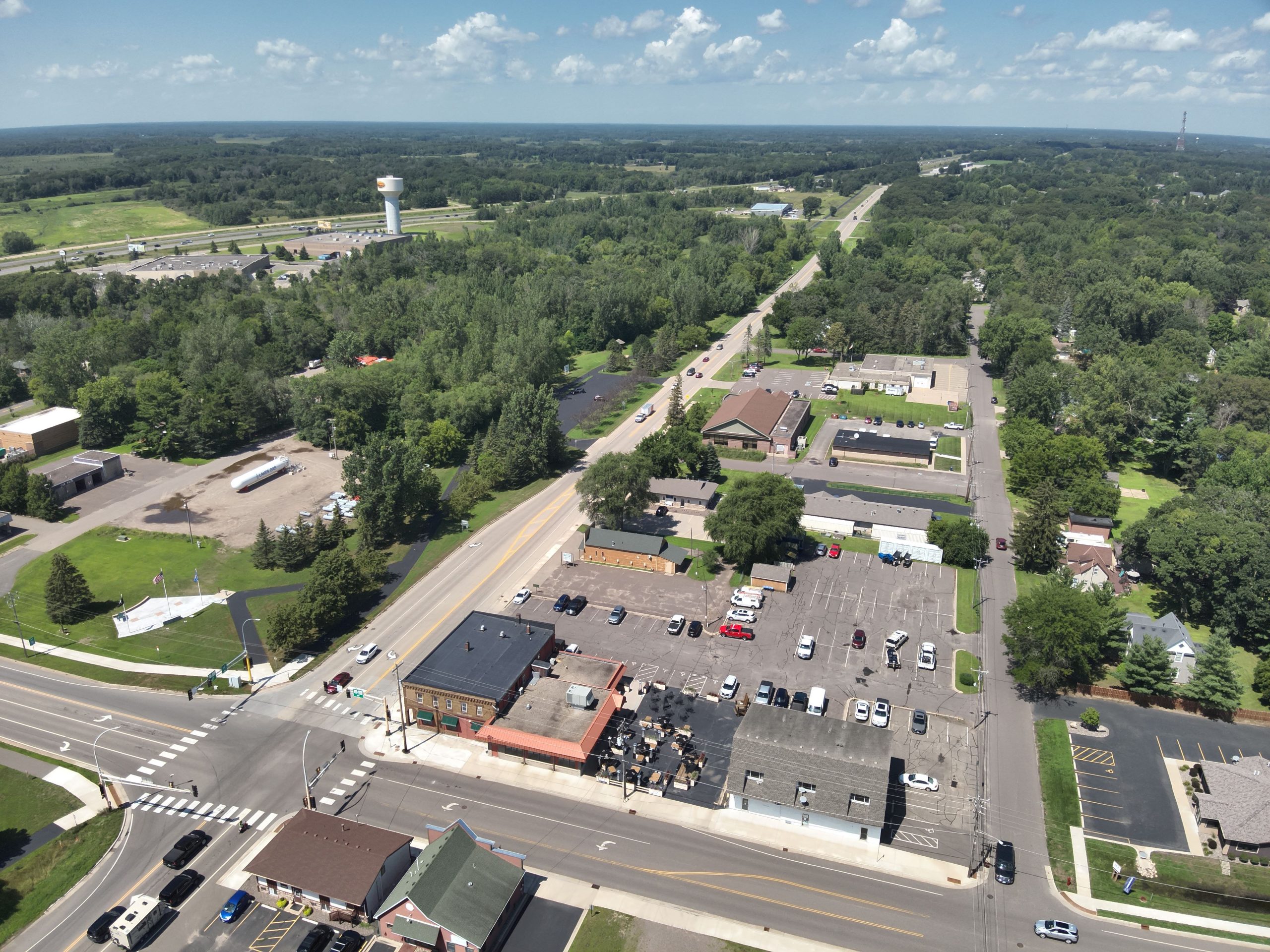
Wyoming, MN
Delivered on August 16, 2024, the complete pavement dataset gave city leaders a comprehensive, network-wide view they could explain in plain terms to residents and the council.
Wyoming, MN Infrastructure Assessment
Summary
- 68 roadway miles scanned with LiDAR and AI, delivered on August 16, 2024
- Actionable pavement condition data and defensible work plans enabled faster projects and clearer communication
- Residents benefit from quicker fixes, safer streets, and better use of taxpayer dollars
Problem
Wyoming, MN faced heavy freeze–thaw cycles and steady commuter traffic that accelerated pavement distress across neighborhood streets and key corridors. Without current, consistent condition data, the city didn’t know which roads to fix or when and struggled to build accurate paving budgets. Public works staff were stuck reacting to complaints and performing manual windshield and foot surveys that were slow, unsafe, and outdated by the time reports were compiled, making it hard to justify plans in town meetings.
Solution
Choosing a faster, data-driven path, the City of Wyoming engaged Cyvl to rapidly survey 68 roadway miles using vehicle-mounted LiDAR and sensors, capturing lane-level cracking, rutting, and surface defects. Within weeks, Cyvl’s Infrastructure Intelligence platform used AI to convert the scans into detailed pavement condition scores, block-by-block repair recommendations, and exportable, defensible work plans and budget scenarios. The city now had trustworthy, up-to-date pavement data for every mile surveyed, along with clear analytics to prioritize work, communicate tradeoffs, and move from analysis to action much faster.
Impact
Delivered on August 16, 2024, the complete pavement dataset gave city leaders a comprehensive, network-wide view they could explain in plain terms to residents and the council. Instead of months of manual surveys and rework, Wyoming received a validated condition model and ready-to-use plans in weeks, shortening the time between identifying issues and putting crews on the street. That speed translated directly to resident benefits—safer travel, quicker attention to the highest-need corridors, and transparent, defensible decisions supported by clear visuals and numbers.
- 68 roadway miles surveyed and scored, enabling block-level plans residents can see and understand
- Weeks-not-months turnaround from data collection to actionable plans, shrinking the gap between issues identified and repairs in the field
- Faster crew scheduling and materials ordering, so potholes and surface defects get addressed sooner and roads stay safer
- Clear, defensible budget scenarios that show efficient use of taxpayer dollars and help secure approvals
- Less reactive 311 load as communications shift from complaints to proactive updates, timelines, and project maps
- GIS exports and ready-to-share visuals make public meetings smoother, shorten decision cycles, and build trust


-%20logo%20(unpadded).png.png)