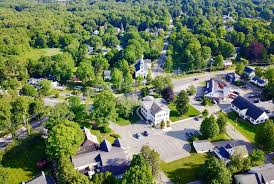
Wenham, MA
With current, trustworthy data in hand, Wenham accelerated planning and moved projects to construction faster, shortening the time residents waited for smoother, safer streets.

Wenham, MA Infrastructure Assessment
Summary
- 30 roadway miles scanned with LiDAR; detailed, actionable pavement condition data delivered in weeks so crews fix issues faster
- 1,018 signs inventoried for safer travel, clearer maintenance priorities, and quicker response to resident needs
- Data-driven paving plan delivered by May 31, 2022, improving budget confidence and public trust
Problem
Wenham’s public works team was relying on outdated, inconsistent pavement ratings and spot checks, leaving them unsure which roads to fix or when and making accurate paving budgets difficult. Crews were walking segments manually, a slow and unsafe process that produced data already out of date by the time reports were finished. As a result, the town often found itself playing defense to resident complaints—answering “Why not my road?” in meetings and struggling to build a defensible, prioritized work plan before the short New England construction season.
Solution
Wenham chose Cyvl to rapidly survey the town’s network, deploying vehicle-mounted LiDAR and sensors to capture high-resolution data across 30 roadway miles. Within weeks—by May 31, 2022—Cyvl’s Infrastructure Intelligence platform used AI to convert raw data into street-level condition scores, a complete sign inventory of 1,018 assets, and a clear set of prioritized repair and maintenance recommendations. Armed with detailed, actionable pavement condition data and defensible reports, town leaders could make faster decisions, communicate transparently, and move from reactive fixes to a confident, proactive program.
Impact
With current, trustworthy data in hand, Wenham accelerated planning and moved projects to construction faster, shortening the time residents waited for smoother, safer streets. The new intelligence provided clear justification for budgets and scheduling, helping staff communicate tradeoffs and timelines in public meetings. Because the city had a comprehensive plan grounded in objective scores, crews focused on the most critical needs first within a multi-year roadmap—without guesswork or politics.
- 30 roadway miles scanned with LiDAR and HD imagery, producing objective condition scores that let crews schedule repairs sooner and reduce pothole risks for drivers and cyclists
- 1,018 signs inventoried, improving safety, ADA compliance, and replacement planning across key school and commuter routes
- Comprehensive, defensible paving plan created in weeks rather than months, with results delivered by May 31, 2022, so construction could start earlier in the season
- Data-backed presentations to residents and boards, reducing “Why not my road?” debates and lowering 311 complaint volume
- Right-sized budget requests and transparent prioritization increased confidence and helped secure funding approvals to stretch taxpayer dollars further
- Work orders and contractor schedules aligned to a ranked, GIS-based list, enabling faster pothole repairs and smoother detours with less disruption


-%20logo%20(unpadded).png.png)