Plainville, MA
With trustworthy data in hand, Plainville moved from reactive to proactive, converting survey results into work orders in weeks instead of months and accelerating visible improvements for residents.
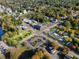
Plainville, MA Infrastructure Assessment
Summary
- 52 roadway miles scanned and analyzed in weeks, not months
- AI-driven condition scores and repair priorities enabled a defensible, transparent paving plan
- Faster fixes and clearer communication led to safer streets and happier residents
Problem
Plainville’s public works team relied on aging windshield surveys and scattered records, so they didn’t know which roads to fix or when and could not produce accurate paving budgets. Outdated and inconsistent data made it difficult to maintain a current asset inventory or build defensible work plans, leaving crews reactive to complaints instead of following a clear prioritization method. At town meetings, leaders were pressed with "Why not my road?" and struggled to justify actions because the evidence was incomplete, creating the perception of bias and fueling 311 calls.
Solution
Plainville selected Cyvl to rapidly survey the entire network using vehicle-mounted LiDAR and pavement sensors, capturing high-resolution measurements across 52 miles of roadway. Delivered in weeks by August 29, 2023, Cyvl’s Infrastructure Intelligence platform used AI to transform raw point clouds and sensor readings into detailed, actionable pavement condition data and segment-level scores for every street. The city received prioritized repair lists and defensible plans and reports that make budgeting, scheduling, and public communication faster and easier.
Impact
With trustworthy data in hand, Plainville moved from reactive to proactive, converting survey results into work orders in weeks instead of months and accelerating visible improvements for residents. Leaders can now explain decisions with clear maps, scores, and tradeoffs, improving trust and reducing back-and-forth at council and neighborhood meetings. The comprehensive analysis across 52 miles helps the city allocate taxpayer dollars efficiently, sequence projects with contractors, and address the highest-need segments sooner to improve safety and ride quality.
- 52 roadway miles scanned with LiDAR and sensors, producing street-level condition scores residents can trust
- Data delivered by August 29, 2023 enabled immediate planning and faster fixes before winter, reducing the time from data collection to implementation
- Actionable repair lists and quantities turned months of manual planning into weeks, speeding up maintenance and paving starts
- Pothole hotspots identified early, enabling faster patching and fewer flat tires for drivers and cyclists
- Transparent maps and reports made town meetings smoother and cut "Why not my road?" debates
- Budget scenarios and defensible plans helped secure and allocate funds with clear taxpayer value
- Work scheduling and contractor coordination streamlined, so crews spend more time fixing streets and less time chasing complaints
- Residents experience safer, smoother travel sooner thanks to data-driven prioritization and rapid execution


-%20logo%20(unpadded).png.png)