North Branch, MN
By July 10, 2025, the City had a complete, GIS-ready pavement assessment for all 88 miles, including segment-by-segment condition scores and a prioritized repair list.

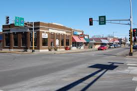
North Branch, MN Infrastructure Assessment
Summary
- 88 roadway miles scanned with LiDAR; reliable pavement condition data delivered by July 10, 2025
- Weeks-not-months turnaround enabled faster fixes and safer streets for residents
- Data-driven, defensible plans replaced guesswork, improving budget use and public trust
Problem
North Branch’s freeze–thaw cycles and growing traffic were accelerating pavement deterioration faster than the City could plan maintenance, yet staff had outdated or inconsistent data to guide decisions. Without a current, citywide view, teams were stuck reacting to 311 complaints and “Why not my road?” questions at public meetings, which made the process appear political rather than objective. The lack of trusted information also made it difficult to defend budgets or build a clear, prioritized work plan that showed efficient use of taxpayer dollars.
Solution
To move faster and bring clarity, North Branch chose Cyvl to obtain an objective, network-wide assessment. Using vehicle-mounted LiDAR and sensors, Cyvl rapidly surveyed 88 roadway miles and captured high-resolution surface distresses across the entire network. Inside Cyvl’s Infrastructure Intelligence platform, AI converted the raw scans into pavement condition scores, segment-level priorities, and defensible multi-year scenarios—complete with shareable maps and reports that let leaders make better decisions and act faster.
Impact
By July 10, 2025, the City had a complete, GIS-ready pavement assessment for all 88 miles, including segment-by-segment condition scores and a prioritized repair list. Delivering results in weeks, not months, shortened the gap between data collection and work in the field, so North Branch could schedule quick fixes and plan overlays with confidence. With objective analysis in hand, the City communicates clearly with residents and council, aligns budgets to need, and directs every dollar toward the greatest community benefit.
- Faster pothole repairs and targeted preservation treatments based on block-by-block condition data
- Noticeable drop in complaint-driven work orders as crews follow a clear, public plan
- Safer driving, biking, and school-bus routes as the most critical segments are addressed sooner
- Budget requests grounded in objective scores, improving approval odds and timing
- Project scheduling streamlined—crews know what to do, when, and why
- Clear maps and reports make council meetings smoother and help answer “Why not my road?” with data
- Weeks-to-delivery means reduced time from survey to construction, accelerating visible improvements for residents


-%20logo%20(unpadded).png.png)