Mendota Heights, MN
With every mile objectively assessed and scored, Mendota Heights built a multi‑year paving and maintenance program in days instead of months.
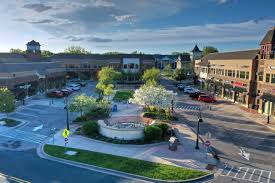
Mendota Heights, MN Infrastructure Assessment
Summary
- 65 roadway miles scanned with LiDAR and AI analysis, delivered on January 27, 2025
- Weeks‑not‑months turnaround enabled faster street repairs and visible improvements for residents
- Data‑driven plans helped Mendota Heights explain priorities and invest taxpayer dollars more efficiently
Problem
Minnesota’s freeze–thaw cycles were accelerating cracking and potholes across Mendota Heights, while material and labor costs rose. The city relied on outdated and inconsistent data and manual windshield surveys, making it hard to know which roads to fix or when and leaving no accurate paving budgets. Staff often had to react to complaints and defend decisions at council meetings without a defensible, citywide prioritization framework.
Solution
Mendota Heights chose Cyvl to rapidly survey the entire network, capturing 65 roadway miles with vehicle‑mounted LiDAR, sensors, and high‑resolution imagery. Cyvl’s Infrastructure Intelligence platform used AI to convert those raw measurements into detailed, actionable pavement condition data for all 65 miles, including objective condition scores, prioritized repair lists, scenario budgets, and ready‑to‑share reports. Delivered in weeks—by January 27, 2025—the city received defensible plans and communication materials that let leaders make better decisions and act faster for residents.
Impact
With every mile objectively assessed and scored, Mendota Heights built a multi‑year paving and maintenance program in days instead of months. The city aligned funding with resident priorities by sequencing projects for safety, impact, and lifecycle cost, and scheduling work to capture the next construction season. Because the results arrived on January 27, 2025, crews and contractors could move quickly from data to bids to boots on the ground, shortening the time between evaluation and visible improvements.
- Safer streets as high‑risk segments are scheduled for near‑term treatments, reducing flat tires, bike hazards, and wintertime rework
- Fewer 311 complaints and smoother council meetings with clear maps, condition scores, and project timelines that explain “why this road, why now”
- Stronger budget justification and approvals using scenario‑based, defensible capital plans that show efficient use of taxpayer dollars
- Faster pothole response, crack sealing, and overlays guided by precise location data and prioritized work orders
- Budget allocation, public communication, and work scheduling are now simpler and faster with trusted data guiding every decision


-%20logo%20(unpadded).png.png)