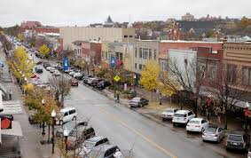
Lawrence, IN
By November 28, 2023, Lawrence had a complete, quality-controlled dataset—delivered in weeks rather than months—so crews and engineers could move from assessment to action without delay.
Lawrence, IN Infrastructure Assessment
Summary
- 194 roadway miles scanned with LiDAR and sensors, delivering citywide pavement intelligence in weeks, not months
- Final dataset delivered on November 28, 2023, enabling faster fixes and safer streets for residents
- Clear, defensible paving plan improved transparency, budget confidence, and timely responses to community needs
Problem
Lawrence’s arterial and neighborhood streets were aging at different rates, but the city relied on outdated and inconsistent information that made it hard to know which roads to fix or when and left paving budgets uncertain. Without a clear prioritization method and a defensible work plan, staff were stuck reacting to 311 complaints and the loudest voices instead of data. Leaders struggled to justify actions in town meetings and defend budget requests, creating delays that residents felt as potholes, detours, and slow repairs.
Solution
To change this, Lawrence chose Cyvl to rapidly survey the entire network with vehicle-mounted LiDAR and sensors, capturing high-resolution pavement condition data across 194 roadway miles. Within weeks, Cyvl’s Infrastructure Intelligence platform used AI to translate raw measurements into pavement condition scores, segment-level priorities, budget scenarios, and ready-to-share reports. The city received detailed, actionable pavement condition data for all 194 miles, unlocking prioritized repair lists and a defensible, transparent plan that enabled faster decision-making and action.
Impact
By November 28, 2023, Lawrence had a complete, quality-controlled dataset—delivered in weeks rather than months—so crews and engineers could move from assessment to action without delay. The fast turnaround empowered staff to schedule resurfacing and maintenance for the highest-priority segments first and clearly explain “why this road, why now” to residents. With precise, citywide condition scores and project-level budgets, leaders could defend funding, coordinate utilities, and communicate timelines, making improvements visible to taxpayers sooner.
- Residents see faster pothole fixes and smoother commutes as crews target the most urgent needs quickly
- Fewer 311 complaints and calmer town meetings thanks to transparent maps, condition scores, and data-backed explanations
- Budget approvals come easier as council members see clear cost projections, risk reduction, and measurable ROI for taxpayers
- Work scheduling, procurement, and contractor coordination are streamlined, letting crews spend more time paving and less time guessing
- Safety improves as hazardous segments are identified early and treated with the right fix at the right time
- Equitable decision-making across neighborhoods reduces perceived bias and builds public trust


-%20logo%20(unpadded).png.png)