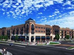
Brownsburg, IN
Within weeks from data collection, Brownsburg had current condition scores for every street segment and a verified inventory of 5,628 signs, giving staff immediate clarity on needs, risk, and safety gaps.
Brownsburg, IN Infrastructure Assessment
Summary
- Data-driven road program delivered in weeks by May 25, 2024, accelerating fixes residents can see and feel
- 165 roadway miles scanned with LiDAR, unlocking detailed pavement condition data to guide repair priorities
- 5,628 traffic signs inventoried to improve safety, compliance, and more accurate budgeting
Problem
Brownsburg is growing fast, and its mix of neighborhood streets and busy corridors made it hard to decide where to direct limited paving funds. The public works team was working from outdated or inconsistent data, which meant they didn’t know which roads to fix or when and struggled with no accurate paving budgets. In council and town-hall settings, leaders found it hard to defend budgets and couldn’t justify actions in town meetings, fueling a reactive cycle to complaints.
Solution
The City of Brownsburg selected Cyvl to rapidly survey its entire network, scanning 165 roadway miles with vehicle-mounted LiDAR and sensors and delivering results in weeks, with final delivery on May 25, 2024. Cyvl’s Infrastructure Intelligence platform used AI to convert the scans into detailed, actionable pavement condition data and a complete inventory of 5,628 signs, all presented in clear, map-based reports and dashboards. With objective condition scores, prioritized repair lists, and defensible plans, the city gained the tools to make better decisions faster and communicate them clearly to residents.
Impact
Within weeks of fieldwork, Brownsburg had current condition scores for every street segment and a verified inventory of 5,628 signs, giving staff immediate clarity on needs, risk, and safety gaps. Delivery by May 25, 2024 enabled the city to schedule maintenance and resurfacing in the same construction season, reducing the time between data collection and project implementation for residents. With trustworthy data for all 165 miles, leaders can justify investments, allocate crews efficiently, and explain project choices in a way residents understand and trust.
- Faster pothole repairs and paving on the highest-need segments, reducing risk for drivers, cyclists, and school traffic
- Fewer 311 calls and complaint emails as residents see transparent maps, timelines, and objective scores for their streets
- Town meetings run smoother with defensible plans, before-and-after imagery, and clear explanations for why a street is scheduled
- Budget requests are easier to defend, showing efficient use of taxpayer dollars and unlocking funding for larger resurfacing programs
- Work scheduling is simpler: crews receive clear, prioritized task lists and coordinate lane closures and signage based on the 5,628-sign inventory
- Public communication improves, with projects launched in weeks instead of months so residents benefit sooner


-%20logo%20(unpadded).png.png)